Emerging Oil Spill Detection Technologies: How Satellites Are Enhancing Our Response Capabilities
The health of our oceans and marine ecosystems is under constant threat from oil spills, which can have devastating impacts on wildlife, local economies, and the environment. Rapid detection and response are crucial in mitigating these effects, and emerging technologies, particularly those involving satellites, are revolutionizing how we tackle this challenge. With the advent of advanced satellite imagery and data analysis techniques, our capability to detect and respond to oil spills is reaching new heights.
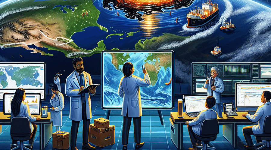
Satellite technology has come a long way since its inception. Today's satellites are equipped with a range of sensors that can detect oil slicks on the water's surface with remarkable accuracy. These sensors include radar systems that can see through clouds and darkness, optical sensors that provide high-resolution images, and infrared technology that can identify the unique spectral signature of oil. By harnessing these tools, responders can quickly locate spill sites and assess their scope, leading to more effective containment and cleanup efforts.
Oil spill detection via satellite is not just about spotting a dark patch on the water. It involves complex algorithms that analyze data to distinguish between oil slicks, seaweed, calm water regions known as "sunglints," and other false positives. This level of sophistication is crucial for effective oil spill prevention and response strategies.
The integration of Artificial Intelligence (AI) into satellite technology marks a significant leap forward in environmental monitoring. AI algorithms can process vast amounts of satellite data at unprecedented speeds, identifying patterns that may indicate an oil spill. This not only speeds up detection but also enhances prediction capabilities by analyzing historical data to identify areas at higher risk for spills.
Artificial Intelligence (AI) is revolutionizing the way we detect and respond to oil spills through satellite technology. This quiz will test your understanding of how AI contributes to this important environmental monitoring effort.
Furthermore, advancements in machine learning allow these systems to improve over time. As more spill events are detected and cataloged, the AI becomes better at recognizing spills quickly and accurately. This ongoing learning process is vital for staying ahead in oil spill cleanup innovations as well as adapting to new challenges posed by changing marine traffic patterns and oil extraction activities.
While satellites provide an eye from above, they are most effective when used in conjunction with other technologies such as drones, buoys equipped with sensors, and ships with specialized skimming equipment. This multi-faceted approach ensures comprehensive monitoring where satellites offer broad surveillance while drones and buoys provide detailed local observations.


The synergy between these technologies is especially apparent during large-scale disasters like the 2010 Gulf of Mexico oil spill. In such scenarios, satellites can direct response teams to priority areas while drones offer close-up views for precise operations—a methodological dance orchestrated for maximum efficiency.
In addition to working alongside other technologies, satellites also play a pivotal role in research and development within the field of oil spill response. By providing consistent monitoring over time, they enable scientists to study the long-term effects of oil pollution on marine ecosystems. Such insights are invaluable for enhancing both our response capabilities today and our prevention strategies tomorrow.
To truly understand the impact of these technological advances on our oceans' health—and indeed on humanity's relationship with its environment—it's essential to consider not only how they work individually but also how they interconnect within larger systems dedicated to ecological stewardship.
In subsequent sections of this article series, we will delve deeper into specific case studies where satellite technology has made a difference in real-world scenarios. We'll explore how these high-tech solutions are being implemented across various regions including the Gulf Coast—home to some of history's most significant spills—and what this means for future incidents.
Stay tuned as we continue to explore these fascinating developments which represent not just innovation but hope—a brighter path forward for safeguarding our planet's precious marine environments against accidental pollution.
The advent of satellite technology has marked a significant leap forward in the way we detect and respond to oil spills. These sophisticated eyes in the sky offer real-time data that is invaluable for rapid response efforts. By integrating satellite imagery with other technologies, such as Geographic Information Systems (GIS), we can analyze spill movements and predict potential impacts on ecosystems and coastlines with greater accuracy than ever before.
GIS is a powerful tool that, when combined with satellite data, provides a multi-dimensional view of an oil spill scenario. It enables responders to visualize the spread of oil in relation to geographical features and sensitive habitats, facilitating more effective containment and cleanup strategies. With GIS, decision-makers can access layers of information including ocean currents, wind patterns, and wildlife locations to enhance their situational awareness.
Satellites have already proven their worth in numerous oil spill incidents around the globe. One notable example is their role in the 2010 Gulf of Mexico oil spill, where they were instrumental in tracking the spread of oil. Another success story is the use of satellites during the California oil spill, which allowed for a swift assessment of affected areas and guided cleanup crews effectively.


Innovation does not stand still, and future advancements promise even more effective detection capabilities. One such development is the emergence of hyperspectral imaging, which can identify different types of materials based on their spectral signature. This means that satellites could soon differentiate between various oil types or distinguish oil from other substances like algae or sewage, leading to more accurate assessments.
Another exciting prospect is the integration of artificial intelligence (AI) with satellite imagery analysis. AI algorithms are being trained to detect patterns and anomalies that may indicate an oil spill, potentially reducing human error and increasing response speeds. The marriage between AI and satellite technology could revolutionize our ability to monitor vast oceanic expanses continuously.
Ongoing research also suggests that satellites equipped with radar technology could play a crucial role in oil spill cleanup efforts. Radar satellites have the advantage of penetrating cloud cover and operating effectively at night, offering consistent monitoring capabilities regardless of weather conditions or time of day.
"The potential for satellite technology to transform our approach to managing environmental disasters cannot be overstated."
As we continue to refine these technologies, it's crucial that we also focus on preventing spills from occurring in the first place. While detection is essential, it's only one part of a broader strategy that includes robust regulatory frameworks, industry best practices, and ongoing research into safer drilling technologies.
Incorporating these cutting-edge tools into our arsenal not only enhances our ability to respond swiftly but also underscores our commitment to preserving marine ecosystems for future generations. The synergy between technological innovation and environmental stewardship holds great promise for mitigating the impact of these unfortunate events when they do occur.
The integration of emerging technologies such as satellites into our response toolkit represents a beacon of hope amidst the daunting challenge posed by oil spills. As stewards of our planet's oceans, it's incumbent upon us to harness these advancements responsibly while continuing our pursuit for even better prevention methods.
The journey towards mastering oil spill detection and cleanup continues as we strive for a safer maritime environment. The collective effort among scientists, policymakers, industry leaders, and concerned citizens will undoubtedly shape our readiness for future challenges posed by oil spills.

Elliot Harper is a seasoned environmental journalist with over a decade of experience covering oil spills and their impact on local communities. He holds a master's degree in Environmental Science and is passionate about making complex issues accessible to all readers.
All Rights Reserved © 2025


Post a comment